Client

City of Jastrebarsko, Jastrebarsko, Croatia

Jaska bike

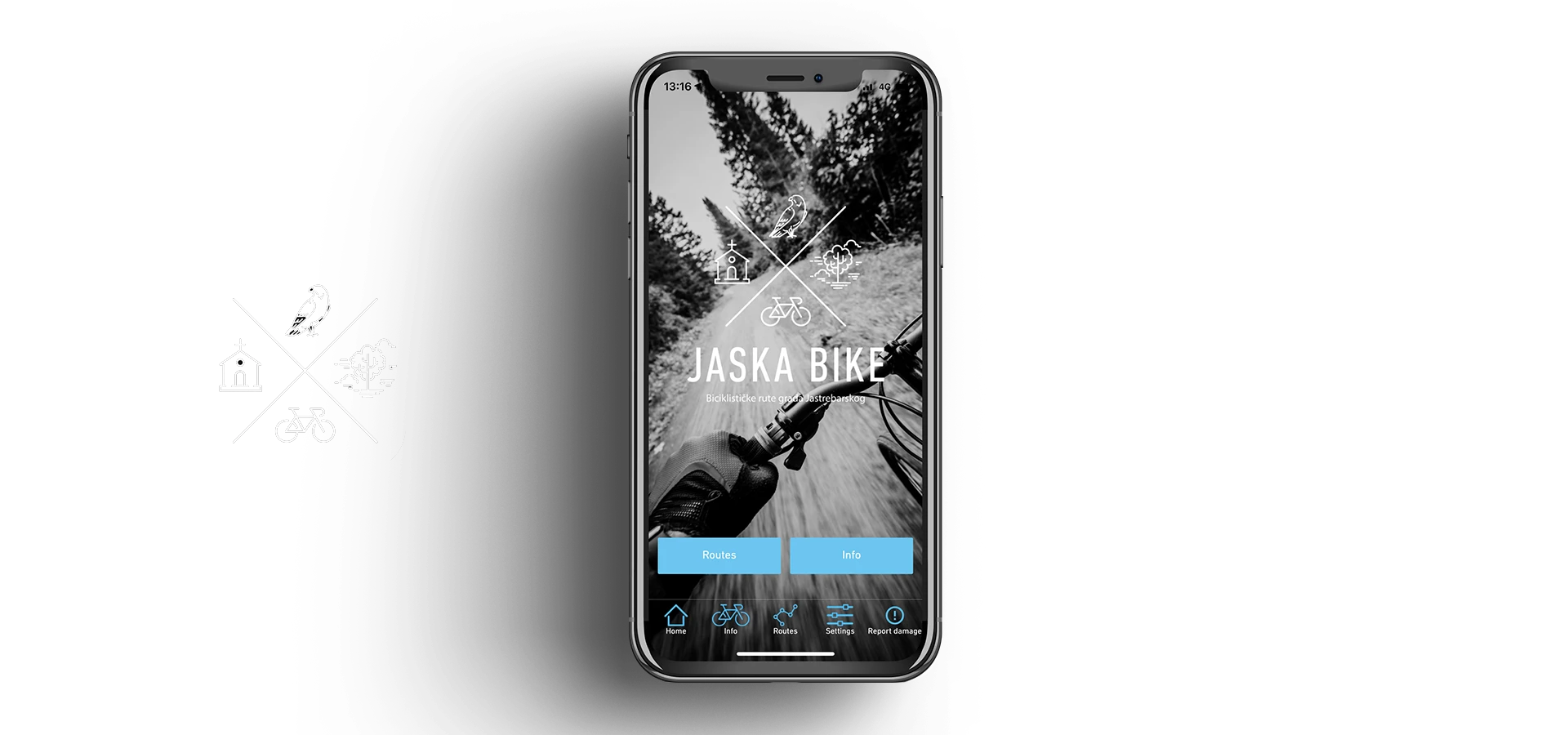
Android and iOS mobile application for bicycle routes in the area of the city of Jastrebarsko

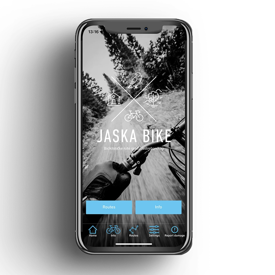
We are told that this mobile app for cycling routes looks great. And we agree that it looks great. The design of the application is actually very simple and the mobile application itself belongs to the group of the simplest mobile applications we have created. The attractiveness of the design is enhanced by several components, namely:

  • bottom menu icons
  • route marker icons
  • dark theme or color contrast black > neon blue > white
  • flat design without blocks  

So simple.

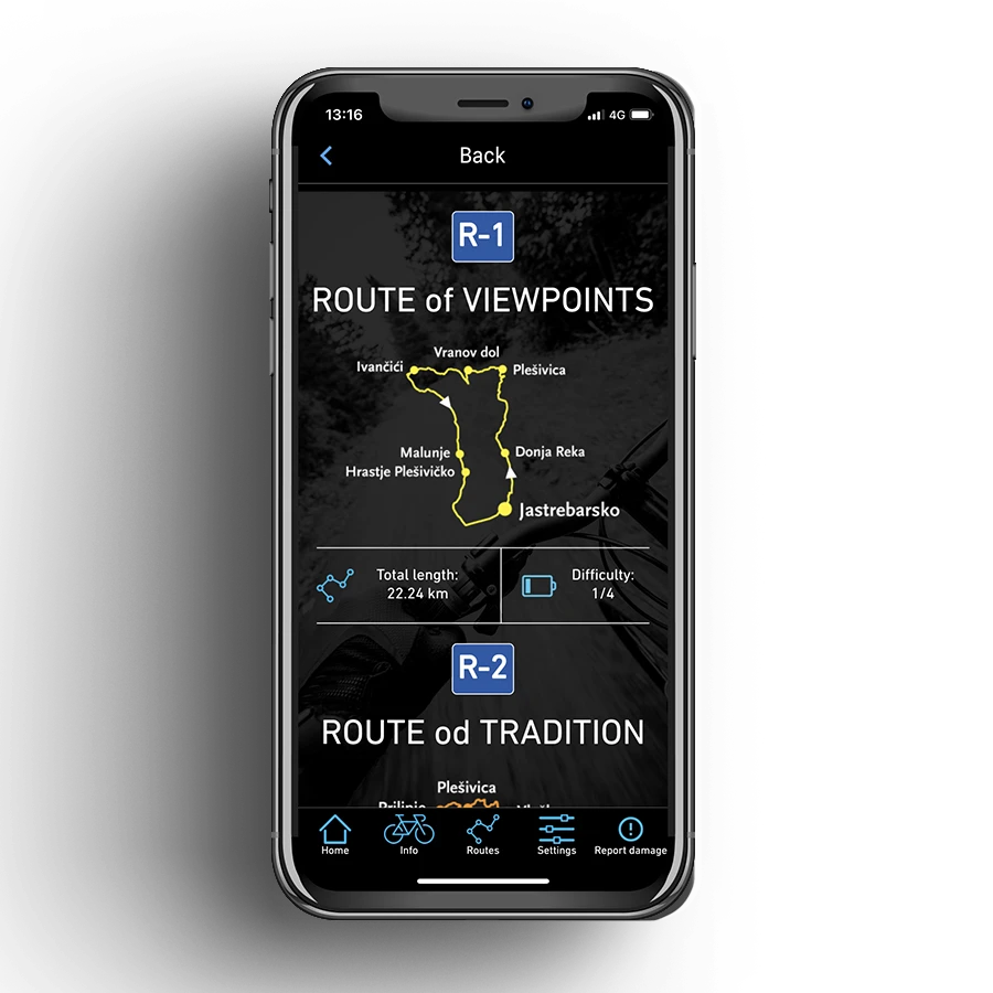
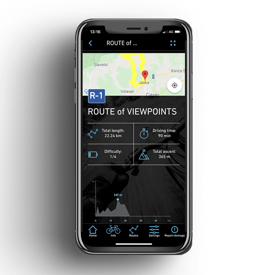
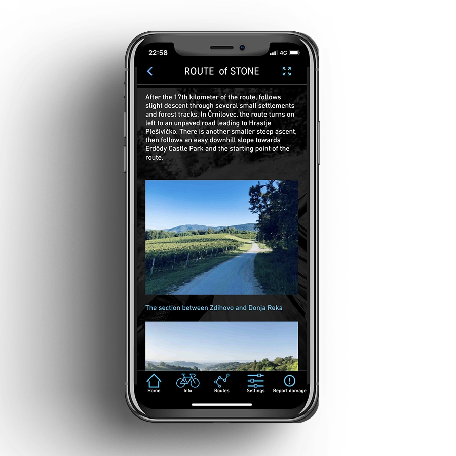
Users of the Jaska bike mobile application can view eight cycling routes and see their total length and weight on the route list. By entering the detailed overview of the route, other data of the cycling route are also displayed:

  • name
  • estimated time required to complete the route
  • total elevation difference
  • list of checkpoints
  • description of the cycling route
  • ability to download GPX file for use in other applications
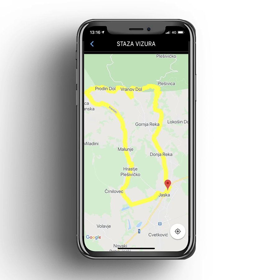
  • display of the route on the interactive map  

Why would someone create or use a mobile application of this type in addition to Google maps and similar applications for navigation?

Primarily because classic navigation applications regarding routes are related to marked roads, trails or roads, while hiking or cycling routes usually pass through unmarked roads. In order to place such uncharted roads or show them on the map, it is necessary to carry out Geo location recording of the route in as many points as possible. The more points we have, the more precise the later drawing of the route on the screen is. Each route point is defined by its latitude and longitude.

Frequently asked questions

Why build a dedicated cycling app when Google Maps already exists?
Google Maps follows marked roads and official trails, but most cycling and hiking routes around Jastrebarsko run along unmarked paths that those apps simply do not know about. To show a trail like that accurately, we recorded the GPS position of each route at many points along the way (each point has its own latitude and longitude), so the line you see on the map matches the actual path on the ground rather than the nearest paved road.
Does Jaska bike work on both Android and iPhone?
Yes. We built it with Flutter, which lets us ship the same app to both Android and iOS from one codebase. That means cyclists get the same routes, the same map and the same features no matter which phone they carry, and the City only had to fund one development project instead of two separate native apps.
What information does each cycling route show?
The route list gives you a quick view of total length and difficulty. Open any of the eight routes and you also get the route name, estimated time to complete it, total elevation difference, a list of checkpoints along the way, a written description, and the trail drawn on an interactive map. So you can size up a ride before you ever leave the house.
Can I use these routes in my own bike computer or navigation app?
Yes. Every route in Jaska bike can be downloaded as a GPX file, which is the standard format that bike computers (like Garmin or Wahoo) and apps like Komoot or Strava can read. Download the route, load it into the device you already ride with, and follow it from there.
We are a town or tourist board with local trails. Can you build something similar for us?
Absolutely, this is exactly the kind of project we enjoy. The hardest part is usually the field work, recording each trail in enough GPS points to draw it accurately, and we can advise you on how to do that or handle it together. From there we adapt the route list, the detail screens, the map and the design to your area and your branding. Send us a message with how many trails you have in mind and we will walk you through it.

Key Results

8 cycling routes
local trails
In Jastrebarsko area
Route details
time, elevation, checkpoints
Estimated time, total difference, list
GPX download
export for apps
Use in other navigation tools
Interactive map
route display
View and navigate trails

Technologies

Flutter
Flutter

Projects from the category